
Review · DRONE PHOTOGRAPHY
Hanksville/Torrey: Bentonite Hills Drone/Photography Tour
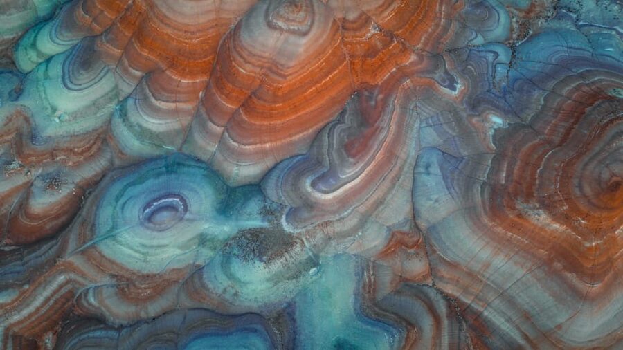
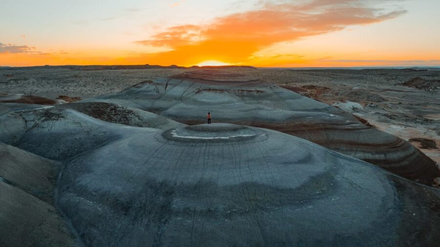
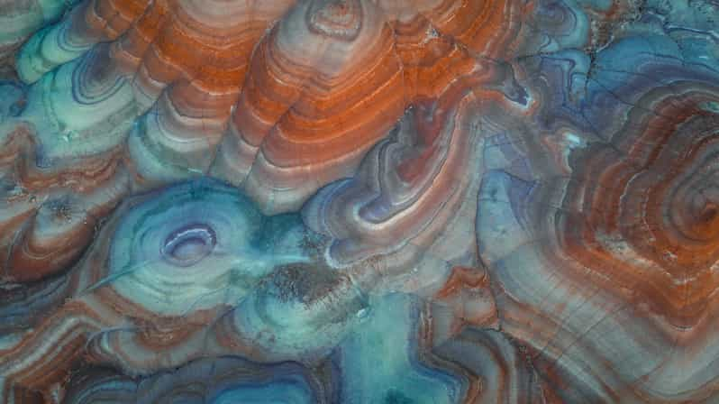
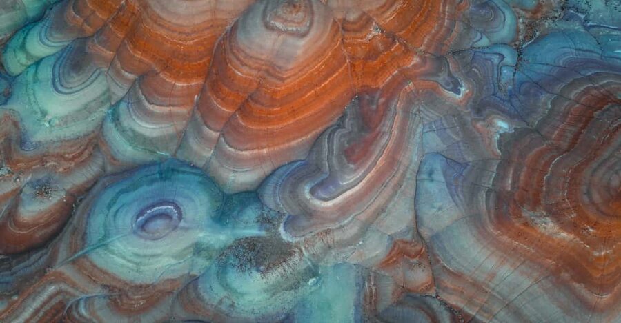
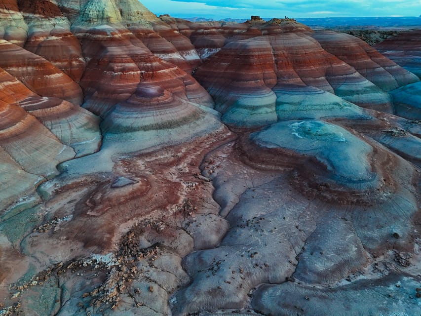
The Bentonite Hills look like a movie set for Mars, with red and blue clay ridges folded into strange, bare shapes. This private three-hour tour takes you by SUV along rocky tracks near NASA’s Mars research facility, then gets you out on foot for photo stops and high viewpoints. I like the direct access to unusual terrain and the chance to learn about the geology from a guide such as Jenny. I also like that pickup, transport, water, and a private group are included.
The main drawback is physical: the best viewpoints require climbing about 50 to 100 feet over uneven ground. The tour is not suitable for people with mobility impairments, low fitness, or those over 60 according to the activity’s restrictions, and weather can force a change or cancellation.
Key points about the Bentonite Hills tour
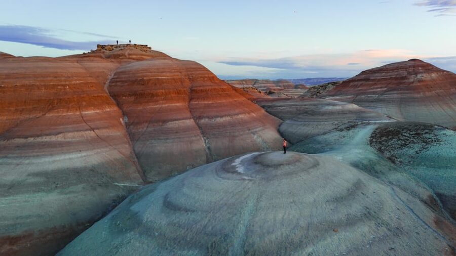
- Mars-like scenery near NASA’s research facility: You explore the striking clay formations around Hanksville, not a themed attraction or a constructed photo set.
- Private three-hour outing: Your group has a live guide rather than joining a large bus tour.
- Jenny is a well-regarded guide: Her tour style combines area geology, local context, and practical help finding the best formations.
- Pickup is included: A black or white SUV marked with Meridian letters collects you in Hanksville, Torrey, or Teasdale.
- Climbing is part of the experience: Plan on walking uphill 50 to 100 feet to reach the most rewarding viewpoints.
- Drone equipment costs extra: A DJI Mini 4 can be rented, and drone video footage is available as an add-on.
Why the Bentonite Hills are worth your time
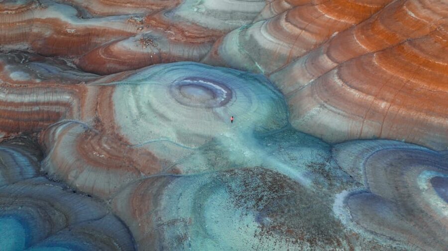
The Bentonite Hills are compelling because the ground itself does most of the work. Rounded ridges and sharply cut folds create bands of red, blue, and earth tones across an otherwise open desert setting. From a distance, the formations can look like another planet. Up close, you see how the clay breaks, slopes, and changes color across the hillsides.
I like this kind of stop because it rewards both casual sightseeing and careful photography. You do not need to be an expert with a camera to appreciate the shapes. If you enjoy composition, the curved ridges give you natural lines to frame. If you prefer a quick look and a few memorable pictures, the setting offers plenty without requiring a full day.
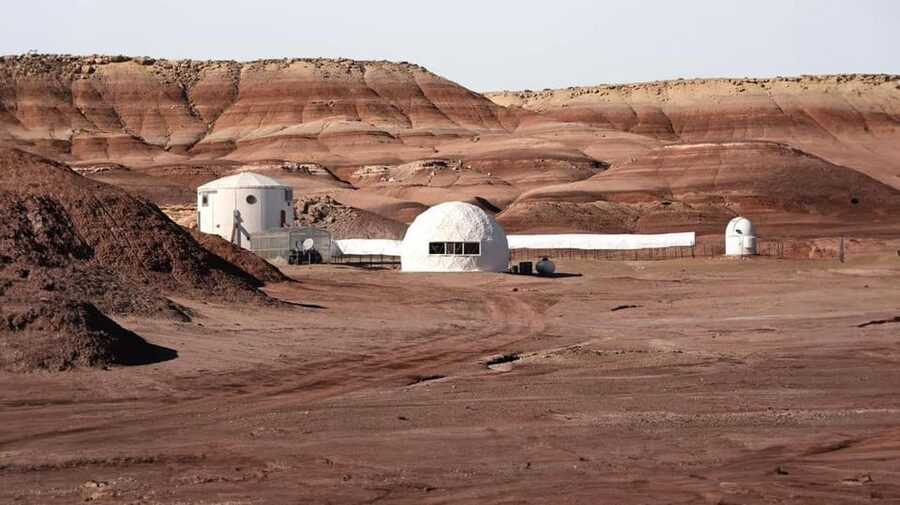
The connection with NASA’s Mars research work adds a useful layer of context. You are not visiting a space facility as part of the tour, but you are exploring terrain near a place associated with testing ideas about Mars. That makes the trip feel tied to real scientific work rather than simply being a scenic drive through southern Utah.
This is also a good example of why a guide can matter in a remote desert area. A first visit may show you the general hills, but a guide can direct you toward particular bends, ridges, and color patterns that work better for photographs. Jenny is specifically named by several people who took the tour, and her explanations cover the geology and the broader area. Mel is also associated with useful advice about other things to do nearby.
More Photography Tours in the USA
- From Waikiki: Best of Oahu Photo Tour with Pickup
★ 4.9 · 274 reviews - The Ultimate LA and Hollywood Photo Tour
★ 5.0 · 233 reviews - Beautiful Colors of Hawaii Photo Tour
★ 5.0 · 165 reviews
What happens during the three hours
The exact order can change with weather and ground conditions, but you can expect the tour to begin with pickup in Hanksville, Torrey, or Teasdale. Look for a black or white SUV with Meridian lettering. Since transportation is included, you do not need to arrange your own off-road vehicle or work out how to reach the trail area independently.
The drive takes you toward the Bentonite Hills near the Mars research facility. The route uses rocky trails, so this is not simply a roadside photo stop. That off-road section is part of the appeal, but it also means conditions can change after rain, during strong winds, or when the surface becomes unsafe.
Once you reach the area, your guide leads you to photo locations across the clay hills. Expect to walk on rough ground and climb short slopes rather than remain beside the vehicle. The required ascent is about 50 to 100 feet, which sounds modest on paper but can feel demanding on loose or uneven clay.
At each stop, you have time to look for patterns, colors, and wide views. The tour is designed around photography, so your guide can help you find better angles and make the most of the unusual terrain. The supplied information does not promise formal camera instruction, but the format gives you a chance to practice framing and work on your own skills.
The final part of the outing returns you to your pickup point. Water is included, a practical touch in a dry setting. With a three-hour schedule, you get a focused look at the area rather than a long full-day expedition. That makes it easier to fit into a wider Hanksville or Torrey itinerary.
The photography value, with or without a drone
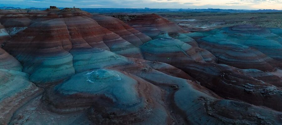
For ordinary cameras and phones, the Bentonite Hills provide strong subjects without much staging. The clay ridges create layers and curves, while the open surroundings help you show scale. Early or late light may change the appearance of the colors, but the tour does not guarantee a specific time of day, so check the available start times before booking if light is central to your plans.
You can come as a beginner. The guide’s job is to take you to worthwhile views and explain the area, while you decide how much technical photography you want to do. A seasoned photographer may appreciate the private format because there is less pressure to keep pace with a large group.
Drone use needs more planning. The DJI Mini 4 is not included, but it is available to rent. Drone video footage is also an add-on, not part of the basic $180 price. If aerial images are your main reason for booking, ask about the rental and footage options before you commit, and confirm what the add-on provides.
I would not assume that renting the drone automatically means you can fly anywhere you want. The tour information only confirms the equipment rental and optional footage. Your guide can clarify the practical arrangements and any conditions on the day.
How the private format changes the experience
The tour costs $180 per person, which is not a bargain-priced scenic shuttle. Its value depends on how much you want the guide, the private setup, and the off-road access.
For a photographer, the cost covers more than transport. You receive pickup and drop-off, a guide, water, and a planned route into difficult terrain. You also avoid the uncertainty of trying to locate the best formations by yourself. If your group includes several people who care about photography, the private format can make the price easier to justify because you are not sharing every stop with strangers.
The private arrangement also lets the outing feel more personal. You can ask Jenny or another guide about the geology, local sights, and photo choices instead of listening to a fixed speech meant for a large crowd. The language options are English, Russian, and Italian.
The value is weaker if you only want a quick roadside view or if you already know the area well. It is also weaker if you cannot comfortably walk uphill. In that case, the tour’s central promise, reaching the strongest vantage points, may not be available to you.
Same backdrop, a different kind of shoot:
- The ‘OG’ Manatee Snorkel Tour with In-Water Guide/Photographer
★ 5.0 · 2,539 reviews - Manatee Swim Tour with In Water Photographer
★ 5.0 · 2,300 reviews - Guided Small Group Manatee Snorkeling Tour with In-Water Photographer
★ 5.0 · 1,336 reviews - LA: Hollywood Sign Tour with Comedians, Dogs, & Epic Photos
★ 4.9 · 1,193 reviews
Jenny, local context, and the guide’s role
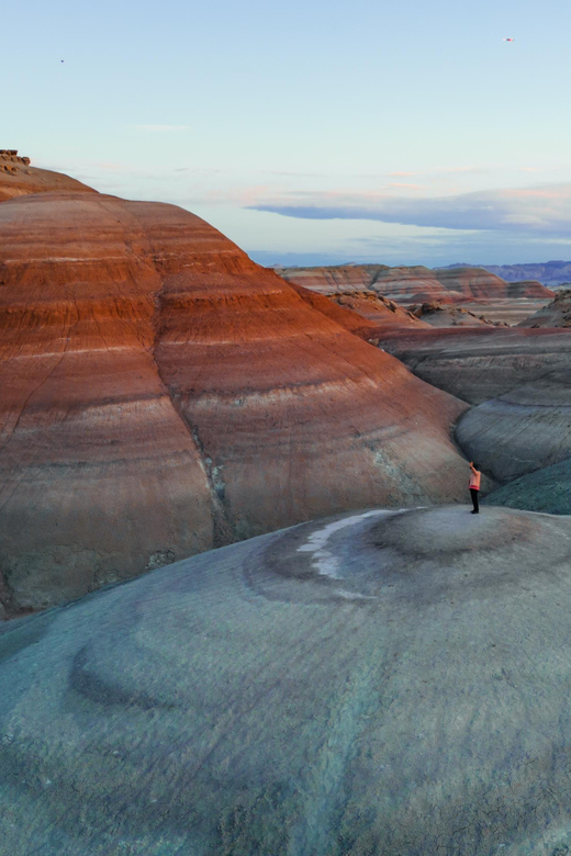
Jenny is the guide most often identified with the experience. She is described as leading people to less obvious Bentonite Hills locations and explaining the area from a geological point of view. That combination matters here because the scenery is unusual but easy to reduce to a few quick photographs.
A good explanation can help you notice why the formations have their particular folds and colors. It also gives the place more meaning than a simple claim that it looks like Mars. The tour is built around discovery, but it remains grounded in the physical setting.
Mel is also connected with the experience and has provided useful directions and suggestions for other area activities. That can be helpful if you are using the tour as one part of a larger southern Utah trip. The supplied details do not promise a full trip-planning service, so treat additional recommendations as a useful extra rather than a formal part of the itinerary.
The guide quality is one of the strongest reasons to choose this tour instead of driving out alone. Just remember that the experience depends partly on the guide you receive and the conditions on your date.
Physical demands and weather concerns
Bring closed-toe shoes. I would treat that as a basic safety requirement, not a casual suggestion, because the ground includes rocky trails and uneven clay. The tour information does not specify a shoe type beyond closed toes, so select footwear that you can walk uphill in comfortably.
The climb of 50 to 100 feet is the most important physical detail. It is not a technical mountain hike, but loose surfaces and desert heat can make short slopes tiring. The activity is specifically not suited to people with mobility impairments, low fitness, or people over 60. That age restriction is unusually direct, so take it seriously when deciding if the tour fits you.
Weather can change the plan. Rain, wind, heat, or changing trail conditions may lead to a modified route, a rescheduled outing, or cancellation. The operator makes the final call on weather, even if a weather app or nearby park website shows different conditions.
That policy may feel frustrating, but it reflects the limits of off-road travel in exposed clay terrain. If your schedule is tight, leave room for a backup plan. The good news is that cancellation is free up to 24 hours before the tour, and you can reserve now and pay later.
Who will get the most from this tour
I would choose this outing if you want unusual scenery and prefer a guide to handle the route. It suits photographers who want help finding strong viewpoints, couples or small groups who value privacy, and visitors staying in Hanksville, Torrey, or Teasdale who do not want to organize their own off-road outing.
It also works for people who enjoy geology and want more context than a quick stop provides. The guide can point out formations and explain the area while you photograph. You do not need professional equipment, and a phone can still capture the strange colors and shapes.
I would think twice if you dislike rough roads, cannot climb short slopes, or want a relaxed sightseeing trip with little walking. I would also avoid booking it as your only plan on a day when poor weather could disrupt a tightly scheduled itinerary.
The tour is aimed at people interested in drone photography, but a drone is not required. You can book the basic experience and use your own camera or phone. If you want aerial video, budget for the DJI Mini 4 rental and the optional footage.
Is $180 a fair price?
At $180 per person, this is a specialty excursion, not a cheap add-on. I see the price as reasonable for a private three-hour trip when you value transport, guiding, off-road access, and photography help. The included pickup from three nearby communities also saves you from arranging a separate drive.
The price becomes more attractive for a group that wants a private vehicle and guide. It becomes less attractive for a solo sightseer who only needs directions to the hills and does not care about geology or photography.
Before paying, confirm whether you want the drone options. The advertised price does not include the DJI Mini 4 or drone video footage, so the final cost can rise. Ask about those add-ons in advance rather than assuming aerial footage is part of the package.
Should you book the Bentonite Hills tour?
Book it if you want a focused, private look at one of southern Utah’s strangest settings, and you can handle a short uphill walk on rough ground. The best reasons to go are the unusual red and blue clay formations, the off-road access, and the chance to learn from guides such as Jenny while working on your photographs.
Skip it if you need an easy-access viewpoint, dislike weather-dependent plans, or cannot meet the physical requirements. If you do book, wear closed-toe shoes, leave space in your schedule for weather changes, and decide ahead of time if the extra drone rental and footage are worth the added cost.
FAQ
Where does the Bentonite Hills tour take place?
The tour explores the Bentonite Hills near Hanksville, Utah, close to NASA’s Mars research facility.
How long does the tour last?
The experience lasts three hours.
How much does the tour cost?
The listed price is $180 per person.
Is pickup included?
Yes. Complimentary pickup and drop-off are available in Hanksville, Torrey, and Teasdale.
What vehicle should I look for?
Look for a black or white SUV marked with Meridian letters and the company logo.
Is this a private tour?
Yes. The tour is offered for a private group.
Which languages are available?
Live guiding is available in English, Russian, and Italian.
Do I need to bring special equipment?
You must bring closed-toe shoes. A camera or phone may be useful for photography, but no specific camera equipment is required by the provided information.
Is a drone included?
No. A DJI Mini 4 is available to rent, and drone video footage can be purchased as an add-on.
Can the tour be changed or canceled because of weather?
Yes. Unpredictable weather and terrain conditions can lead to a modified route, rescheduling, or cancellation. The operator makes the final weather decision. You can cancel up to 24 hours ahead for a full refund.
More Drone Photography in the USA
- Miami/South Beach: Clear Kayak Photoshoot with Drone
★ 4.2 · 10 reviews - From Bangkok: Pattaya Island Trip with Drone Photos
★ 4.3 · 292 reviews - Clear Kayak Drone Photo Shoot and Video in Montego Bay
★ 5.0 · 275 reviews - Clear Kayaks Drone Photoshoot in Nassau,Bahamas.
★ 5.0 · 141 reviews
Just added around the USA
- Focus on Haines Private Nature / Photography tour★ 5.0 · 38 reviews
- Exclusive Photography Tour Haines Departure★ 5.0 · 19 reviews
- Private Proposal Professional Photo Shoot – Grand Canyon★ 4.5 · 2 reviews
- Hire Photographer, Professional Photo shoot – Grand Canyon★ 5.0 · 29 reviews
- Photoshoot in Grand Canyon★ 5.0 · 2 reviews
- Full Day Guided Wildlife Photography Tour In Yellowstone★ 5.0 · 6 reviews
- Miami incredible Photoshoot – Private Session with a Professional Photographer★ 5.0 · 2 reviews
- Modern Vibe Fort Lauderdale Las Olas Photography Session★ 5.0 · 2 reviews
Drone Photography, side by side.


Clear Kayak Drone Photo Shoot and Video in Montego Bay
Read our review →
Clear Kayaks Drone Photoshoot in Nassau,Bahamas.
Read our review →
Clear Kayak Drone Photoshoot in Nassau Bahamas
Read our review →
Drone Clear Kayak Barbados Photoshoot Experience
Read our review →
Aruba Unique Clear Kayak Drone Photoshoot with Video
Read our review →

Lists this one turns up in